科学家利用卫星影像评估边境洪灾成因
分类科技
事件时间2026-08-28
地点尼泊尔-中国边境
来源基里报
发布时间2026/08/28 09:22
详情描述
2026年8月28日,尼泊尔与中国边境地区发生灾难性洪水。目前,救援队伍正在受灾区域搜寻失踪人员。
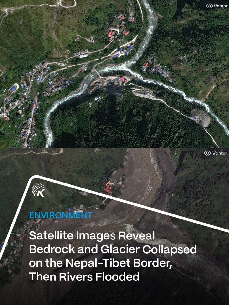
与此同时,地球科学家正通过分析卫星影像,对此次洪灾的成因进行调查,并评估受灾区域的破坏程度。相关研究旨在通过影像数据获取灾害线索,以明确洪水发生的具体原因。
📋 简要摘要 ▸
针对尼泊尔与中国边境的灾难性洪水,地球科学家正通过卫星影像分析灾害成因,并评估受灾区域的破坏程度。
📋 完整原文 ▸
As rescue teams searched for missing people following catastrophic flooding along the Nepal-China border, Earth scientists reviewed satellite imagery for clues to the cause and assessed the devastation
https://kiripo.st/GNtYph